NWC: close the demo and go back to Newcastle Web Co

Demo by Newcastle Web Co. This is a demo design and not a real business. Every design is one of one: when a business picks it, no one else gets it.

Demo, not a real business.

Lic. 000000C (demo)

Lic. 000000C (demo)

Residential builders in Newcastle

Newcastle

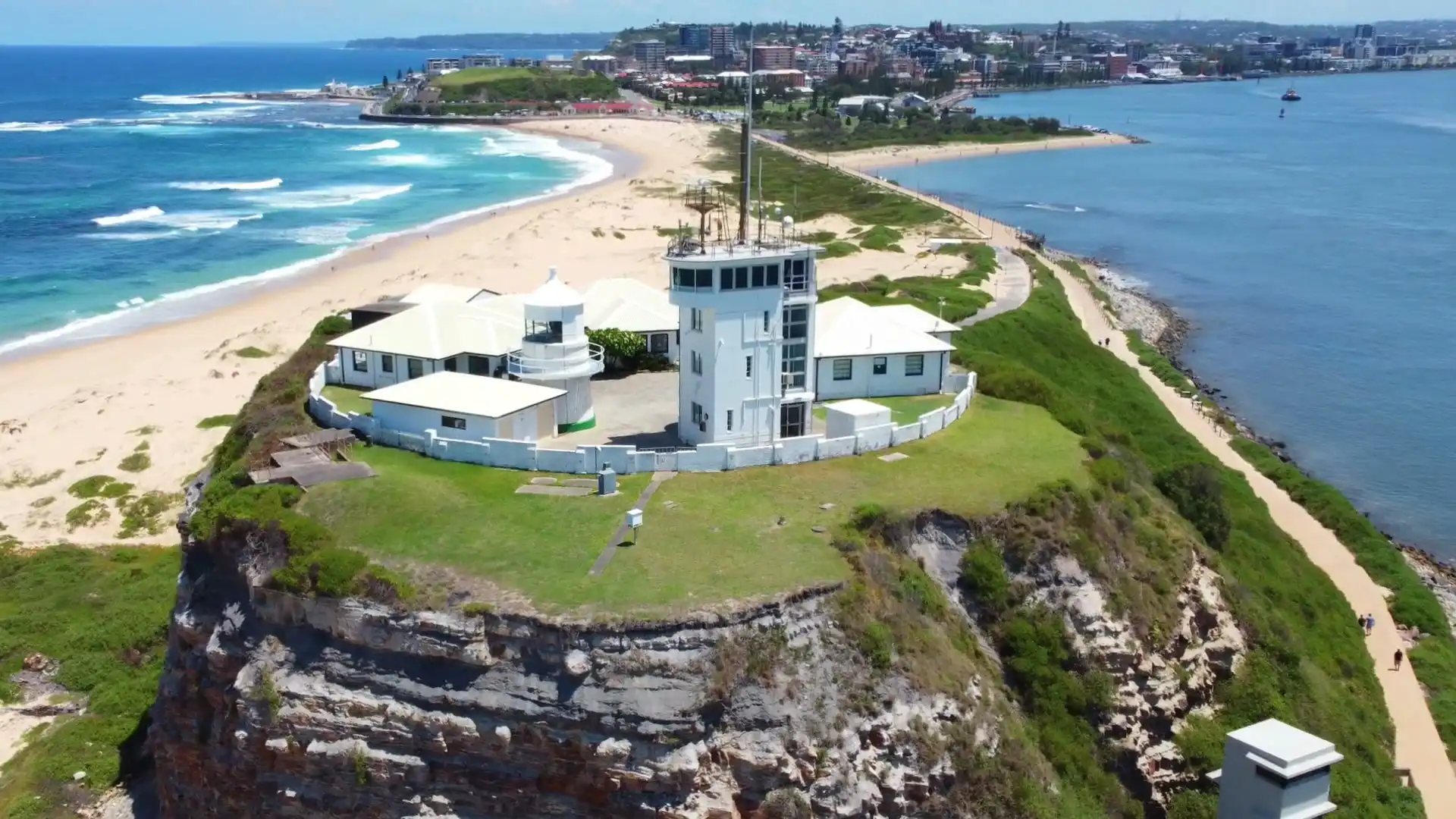
We're residential builders in Newcastle, based in Merewether, and most of the city we work in sits over old coal workings, beside bush, near the ocean or inside a heritage conservation area. Some streets carry all four, which is why this page starts with the rules and only then gets to the suburbs.

Book a site visitSuburbs

Newcastle's rules change from one street to the next, so we read the lot before anyone draws the house.

Residential builders in Newcastle: the local rules

The City of Newcastle plans through the Newcastle LEP 2012 and the Newcastle DCP 2023, and much of it lies inside the Newcastle Mine Subsidence District, the current map gazetted on 1 July 2017. Bush comes into the city at Glenrock in the south and Blackbutt Reserve in the west, the ocean suburbs sit under the state's coastal maps, and council's flood planning covers three kinds of water: flash flooding, Hunter River floods and storm surge.

Mine subsidence across the city

The Newcastle Mine Subsidence District takes in some suburbs whole and others in part. Merewether, Merewether Heights and Bar Beach are inside it from one boundary to the other; Hamilton is split, with its southern part inside; and Mayfield has only a small corner in it. Each property in the district has a surface development guideline, and the guideline, not the suburb, sets the footings, the slab and sometimes the length of the house. Council's DCP asks for subsidence to be considered at preliminary design, and that's when we look it up.

Bush, coast and flood

Two big reserves bring bush fire mapping into the city. Glenrock runs along the south-western edge behind Merewether and the Heights, and Blackbutt Reserve sits on the western side of New Lambton. A lot on or near that mapping needs a Bushfire Attack Level before design. Along the ocean, the state's coastal use and coastal environment maps cover much of Bar Beach and the eastern side of Merewether. The state's flood planning map is empty for Newcastle, so council's mapping and its certificates are the source, and we never treat a suburb as clear of flooding because it isn't on a list.

Heritage conservation areas

Newcastle has more heritage controls than anywhere else we build. The DCP's nine conservation areas each have a character statement, and inside one an addition joined to the house goes to council. Heritage items, from terraces and cottages to whole flat blocks, close the faster approval routes altogether.

How the suburbs differ

  • Merewether: our base, from the ocean baths back to Glenrock, and the suburb where one lot can collect the most separate rules.
  • Merewether Heights: the hill above it, where the subsidence guideline decides whether a back deck needs the agency at all.
  • Hamilton: five conservation areas meet here, on lots with barely a garage between them.
  • Bar Beach: almost half parks and beaches, the rest flats and houses on high ground mapped as coastal use land.
  • New Lambton: low on its eastern side, high and bush-edged towards Blackbutt, with a strong share of Guideline 1A lots.
What we build in Newcastle

  • New builds and knock down rebuilds

    On a Newcastle lot the subsidence guideline sets the slab and sometimes the length and footprint of the house, so we read it before the new home is drawn, and the bushfire report too on the bush-edge streets.

  • Extensions

    Out the back or up a storey, an extension here meets the guideline, the flood certificate and, in a conservation area, council, since an attached addition there is a development application.

  • Renovations

    The city's older suburbs carry most of its heritage, so a renovation in Hamilton or Cooks Hill starts with the character statement in council's plan, and a new kitchen on a listed house goes to council.

  • Bathrooms

    Many of the city's bathroom renovations are in strata flats near the beaches, where the owners corporation, and on a listed block council too, approve the work before we strip a tile.

  • Decks

    On the hill suburbs a deck may sit well off the ground, and the guideline decides whether Subsidence Advisory's exempt list covers it, while the bush buffer along Glenrock sets the materials.

  • Granny flats

    Where a lot is under 450 m², a granny flat can't be complying development unless it sits wholly inside the existing house, and in some of the city's suburbs that's most of the lots, so the route is a development application.

Tell us the street address and what you'd like to build. Before we visit we'll have looked up its guideline, the heritage, bush fire and coastal layers, and whether a flood certificate is needed.

Book a site visit(02) 5550 4806

Building in Newcastle: your questions

How do I find out if my Newcastle property is in the mine subsidence district?

Open the NSW Planning Portal, go to its Spatial Viewer, type in the address and turn on the layer called Mine Subsidence Development. It shows whether the lot is inside a district and which surface development guideline it carries. Inside a district you need Subsidence Advisory NSW's approval before building work starts. Under the Newcastle DCP 2023, plans stamped by the agency go in with a development application, so we design to the guideline from the first sketch.

What is a Flood Information Certificate, and when should we order one?

It's City of Newcastle's statement of the flood information it holds for one property. Council's controls apply to land that is partly or fully within the probable maximum flood extent: property controls use the 1% AEP flood in 2050, and life-safety controls use the probable maximum flood. Order the certificate before design, because it sets the floor level and where on the lot new rooms can go.

Which parts of Newcastle are heritage conservation areas?

The Newcastle DCP 2023 sets out nine of them, each with its own character statement. Among those we work in are Cooks Hill, which covers most of that suburb, the Hamilton Residential Precinct and Cameron's Hill, the small Glebe Road Federation Cottages area in The Junction, and Hamilton South Garden Suburb, which reaches into the north of Merewether. The heritage layer on the Spatial Viewer shows whether your lot is inside one.

Do you build in Lake Macquarie as well as Newcastle?

Yes. We work across Lake Macquarie City too, where the planning runs on the Lake Macquarie LEP 2014 and DCP 2014, the lake brings council's waterway flooding policy into play, and the mine districts and bush mapping fall differently. Our Lake Macquarie page goes through those suburbs the same way this one goes through Newcastle's. Both areas are reached from our base in Merewether.

What did the 2007 Pasha Bulker storm change for building in Newcastle?

It shaped the flood planning that applies now. The June 2007 storm was similar in size to a 1% AEP event, and it informed council's Throsby, Styx and Cottage Creek Flood Study, adopted on 12 December 2023. That study uses the 1% AEP flood in 2050 as its planning flood, and it's one reason we ask for a flood certificate early.

Does council or a certifier approve building work in Newcastle?

Either, depending on the lot. Where the lot qualifies, a certifier you appoint can approve a complying development certificate. A heritage item, a conservation area for an attached addition, a flood control lot outside the certified part, or a BAL-40 or flame zone rating can send it to council instead. In the subsidence district, Guidelines 2, 3, 3A, 6 and 8 can be approved without referral; Guidelines 1, 1A, 4, 5 and 7 go to Subsidence Advisory.